Contact
QR code for the current URL

Story Box-ID: 1166102

GeoCue Group Inc. 520 6th Street 35756 Madison, Alabama, United States https://www.geocue.com
Contact Bret Burghdurf
Company logo of GeoCue Group Inc.

GeoCue and Argosdyne Announce Partnership to Expand Drone Mapping Solutions in East Asia

The new distributor brings TrueView LiDAR and LP360 software to East Asian drone surveying market

(PresseBox) (Huntsville, AL, )
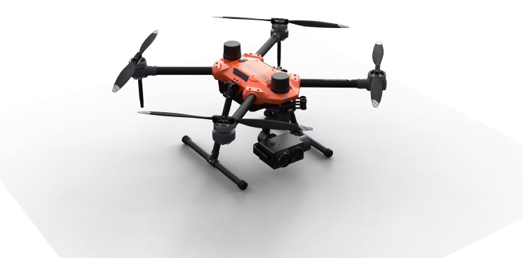
GeoCue, a leader in LiDAR mapping hardware & software solutions, announces its expansion into East Asia through a strategic partnership with Argosdyne, a prominent drone manufacturer and supplier. This collaboration will strengthen GeoCue's global distribution network and enable Argosdyne to offer TrueView 3D Imaging Sensors and LP360 LiDAR Processing Software to customers in South Korea and throughout East Asia.

Argosdyne, established in 2018, has quickly emerged as a key player in the drone industry, specializing in the manufacturing of drones and docking systems. With a diverse clientele and successful partnerships with organizations such as Samsung Electronics Factory, Hyundai Motors, and Hyundai E&C, Argosdyne has demonstrated its commitment to delivering high-quality solutions across various sectors, including surveillance and aerial mapping services.

Seunghyun Jung, CTO of Argosdyne, expressed his enthusiasm about the partnership, stating, "Our unique differentiating factor lies in our IT-based technological expertise, allowing us to seamlessly transition from the surveillance market to the mapping market. By joining forces with GeoCue, we are excited to offer our customers GeoCue's industry leading TrueView Lidar products and LP360 software, which will provide them with accurate and valuable information in a user-friendly manner."

Jung anticipates that the main users of GeoCue products and software in East Asia will include construction companies and audit firms, as the demand for mapping drones continues to rise within the construction industry. The integration of GeoCue's comprehensive mapping hardware and software solutions will provide customers with a seamless and more efficient workflow.

Abdel Diani, Director of Global Distribution for GeoCue, helped facilitate the new partnership. "We look forward to growing our presence in East Asia by partnering with Argosdyne,” said Diani. “Their expertise in drone manufacturing and their strong presence in East Asia will greatly enhance our ability to serve customers in the region. We are confident that this collaboration will bring tremendous value to our customers and further accelerate the adoption of advanced mapping solutions."

This partnership between GeoCue and Argosdyne opens new opportunities to offer high-quality 3D Lidar products and software sourced from North America to the global market. With this partnership, customers in East Asia will have access to industry-leading solutions from GeoCue, further empowering their mapping and surveying operations.

About Argosdyne:

Argosdyne is a prominent drone manufacturer and supplier, specializing in the production of drones and docking systems. Established in 2018, the company has quickly gained recognition for innovative, IT-driven technological expertise. With a focus on IT-based technological expertise, Argosdyne offers comprehensive solutions to various sectors, including surveillance and aerial mapping services.

Argosdyne serves a diverse clientele, including major organizations such as Samsung Electronics Factory and Hyundai Motors. They are committed to providing comprehensive, integrated solutions that meet the specific needs of customers.
Website Promotion

Website Promotion

GeoCue Group Inc.

GeoCue and Microdrones have joined together to bring geospatial experts the best in drone surveying equipment, geospatial software, workflow, training and support for high accuracy LiDAR and drone mapping to help civil engineering and surveying professionals achieve successful data collection, processing, and management.

With TrueView drone LiDAR/Imaging sensors, LP360 point cloud data processing software, and fully integrated systems from Microdrones, we are the leader in LiDAR mapping processing in North America able to meet customers where they are in terms of technology adoption, budget, and resources.

The publisher indicated in each case (see company info by clicking on image/title or company info in the right-hand column) is solely responsible for the stories above, the event or job offer shown and for the image and audio material displayed. As a rule, the publisher is also the author of the texts and the attached image, audio and information material. The use of information published here is generally free of charge for personal information and editorial processing. Please clarify any copyright issues with the stated publisher before further use. In case of publication, please send a specimen copy to service@pressebox.de.
Important note:

Systematic data storage as well as the use of even parts of this database are only permitted with the written consent of unn | UNITED NEWS NETWORK GmbH.

unn | UNITED NEWS NETWORK GmbH 2002–2024, All rights reserved

The publisher indicated in each case (see company info by clicking on image/title or company info in the right-hand column) is solely responsible for the stories above, the event or job offer shown and for the image and audio material displayed. As a rule, the publisher is also the author of the texts and the attached image, audio and information material. The use of information published here is generally free of charge for personal information and editorial processing. Please clarify any copyright issues with the stated publisher before further use. In case of publication, please send a specimen copy to service@pressebox.de.