SARscape® has been conceived to offer a complete suite of state-of-the-art algorithms to appropriately and efficiently generate the above mentioned products based on SAR technology. In addition, in order to optimize the information extraction, dedicated methods have been developed by considering the synergy between SAR and Optical data. It is worth mentioning that the large spectrum of functionalities - which are continuously upgraded - have been developed, in primis, within projects financed by the European Space Agency, but also under activities sponsored by the private sector.
SARscape® is a modular set of functions dedicated to the generation of products based on airborne and spaceborne Synthetic Aperture Radar (SAR):
- ERS-1/2 SAR
- JERS-1 SAR
- RADARSAT-1
- ENVISAT ASAR
- ALOS PALSAR
- TerraSAR X-1 (2007)
- RADARSAT-2 (2007)
- RISAT (2007)
- OrbiSAR-1 (X- and P-band)
and spaceborne optical multi-spectral data,
- SPOT VEGETATION
- MODIS
- ENVISAT MERIS
- LANDSAT Thematic Mapper/ETM+
- SPOT-4/5
- IRS-6
- IKONOS
- QuickBird
A peculiarity of SARscape® - which supports Windows 98/NT/2000/XP and Linux 2.6 operating systems - is that it runs on Personal Computers and is interfaced to ENVI® (ITT VIS Inc.) and ArcView® (ESRI Inc.) environment, hence enabling to simply launch the processing functions via standard dialog panels. Further, in order to facilitate the products compatibility between the two environments, products generated under an environment can be directly imported and further processed in the other one.
The SARscape® package consists of seven complementary modules:
1. Basic
The Basic module includes a set of processing functions (e.g. focusing, multi-looking, co-registration, despeckle filters, feature extraction including the interferometric coherence, geocoding with radiometric calibration and normalisation, mosaicing) for the generation of products based on SAR intensity and coherence. This module includes also a wide variety of tools (from special colour composites generation, to Digital Elevation Model import and interpolation, to cartographic and geodetic transforms) as well as optical data processing capabilities (ortho-rectification, radiometric calibration, pan-sharpening, etc.). Dedicated segmentation and classification algorithms support the information extraction of both SAR and optical multi-spectral data. Segmentation is performed on single- and multi-sensor, and multi-temporal data, while classification is supported by Maximum Likelihood, Neural Network, Support Vector Machines, Hierarchical Clustering, and Temporal Signature algorithms (note that except the Hierarchical Clustering, all classifiers are pixel and contextual based).
2. ASAR, RADARSAT-1, PALSAR Focusing
The Focusing module - developed by Aresys a spin-off company of the Politecnico of Milan - extends SARScape® focusing capabilities to RADARSAT-1 (Fine Beam and Standard Beam), ENVISAT ASAR (Alternating Polarisation, Image, and Wide Swath modes), and ALOS PALSAR (Fine Beam, ScanSAR, and Polarimetric) data. In all cases an optimised phase preserving ?-k processor is adopted.
3. Gamma & Gaussian Filter
The Filter module includes a whole family of SAR specific filters, which are based on Gamma/Gaussian-distributed scene models. The algorithms are developed by Privateers N.V. These filters, which add to those available in the Basic module, can be run on Single Look Complex (SLC) as well as detected Intensity single- or multi-channel data. Specific algorithms are also implemented for the optimal filtering of full polarimetric data. They are particularly efficient to reduce speckle, while preserving the radar reflectivity, the textural properties and the spatial resolution, especially in strongly textured SAR images.
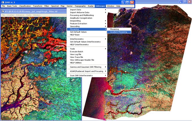
An example of the capability of these three modules is given in the figure below, where a multi-temporal mosaic of four adjacent ENVISAT ASAR AP orbits covering about 2/3 of Senegal is shown. The ESA standard ASAR APO products (float pass-float scene) have been previously focused, multilooked, filtered and geocoded by means of the Focusing, Gamma & Gaussian Filtering, and Basic SARscape® modules. Note that all processing (from raw to the final mosaic product) has been performed in a fully automated way.
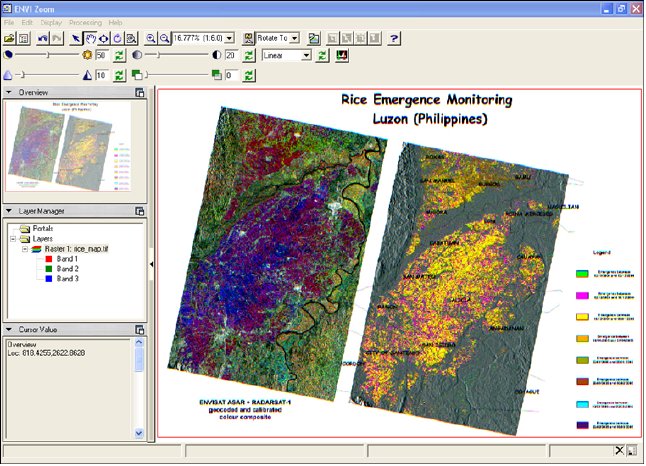
A further example is given in the figure below. In this case multi-temporal ENVISAT ASAR IM and RADARSAT-1 Fine Beam SLC data have been multilooked, filtered (using a dedicated multi-temporal despeckling algorithm) and geocoded. In is worth mentioning that in this case the Digital Elevation Model - which has been used for the SAR geocoding - has been extracted from the internet freeware SRTM-3 tiles and mosaiced. This process (i.e. SRTM-3 download, mosaic of tiles and dummy area interpolation) is executed, in a fully automatic way, by simply inputting the SAR reference scene.
4. Interferometry (InSAR/DInSAR)
The Interferometry module supports the SAR data processing, in interferometric mode (i.e. 2-pass interferometry, InSAR) and in Differential Interferometric mode (i.e n-pass interferometry, DInSAR), aimed at the generation of Digital Elevation Models, Coherence images and Land Displacement maps starting from SLC data.
The example here below shows a Landsat 7 ETM+ image draped over an Interferometric DEM generated from several ascending and descending ERS-1/2 SAR tandem pairs. It must be noted that the Landsat image has been previously geocoded and radiometrically corrected with the SARscape® Basic module. The area imaged in this shaded view, illuminated from Southeast direction, corresponds to the Southern Swiss Alps
5. ScanSAR Interferometry (InSAR/DInSAR)
The ScanSAR Interferometry module - developed by Aresys on the basis of original algorithms from Politecnico di Bari (POLIBA) - extends the Interferometry module capabilities to the ScanSAR acquisition mode, making so possible to generate Digital Elevation Models, Coherence images and Land Displacement maps of large areas (around 500 X 500 km).
An example, showing the Afar region (Ethiopia), is presented here below. It witnesses an important rifting event happened in 2005 along this tectonic plate triple junction. The deformation of the lithosphere was beautifully captured by a sequence of ENVISAT ASAR (IM and WS mode) acquisitions. The example shows, beside the Google Earth reference image (upper left), the interferogram (upper right) generated by means of the ScanSAR Interferometry SARscape® module. It has been produced starting from an ENVISAT ASAR Wide Swath data pair acquired 6 months apart (respectively in June and December 2005). The bottom image shows the faded interferometric fringes draped over the Google Earth optical reference. It is worth while to note that each interferogram fringe (a complete colour cycle - from yellow to blue) represents a displacement of about 2.8 cm along the satellite view direction.
Amid the suite of tools provided with the SARscape® Basic module, there is also the possibility to generate products compatible to the Google Earth format (.kml file). It enables to display any SARscape® geocoded products (e.g. the images here above) into the Google Earth environment by simply double clicking on it with your mouse.
6. SAR Polarimetry and Polarimetric Interferometry (PolSAR & PolInSAR)
The PolSAR & PolInSAR module will support the processing of polarimetric (ALOS PALSAR, RADARSAT-2, and TerraSAR-X-1) and polarimetric interferometric (ALOS PALSAR) SAR data. In particular, concerning the ALOS PALSAR, the following features will be made available with the SARscape® 3.0.000 version:
Images copyright by ESA and JAXA
7. Permanent Scatterers (PS) The Permanent Scatterers module - developed in collaboration with Aresys and released in the first quarter of 2007 - enables to determine mm-scale displacements of individual features on the ground.
About sarmap
sarmap s.a. is a Swiss company founded in January 1998 as spin-off of the Remote Sensing Laboratories, University of Zurich. sarmap provides software development, applications, and consultancies in the remote sensing field, particularly airborne and spaceborne SAR data processing. Further information is available at www.sarmap.ch web site.


